

Love staring at a map and discovering something interesting? Then “Mapping the Great Lakes” is for you. It’s a monthly Great Lakes Now feature created by Alex B. Hill, a self-described “data nerd and anthropologist” who combines cartography, data, and analytics with storytelling and human experience. He’s the founder of DETROITography and authored “Detroit in 50 Maps,” a book published in 2021. Find all his Great Lakes Now work HERE.
The Great Lakes can claim multiple physical and ecological anomalies from the large inland lakes themselves to the density of sugar maples or even the abundance of underground salt deposits, thanks to the ancient glacial activity.
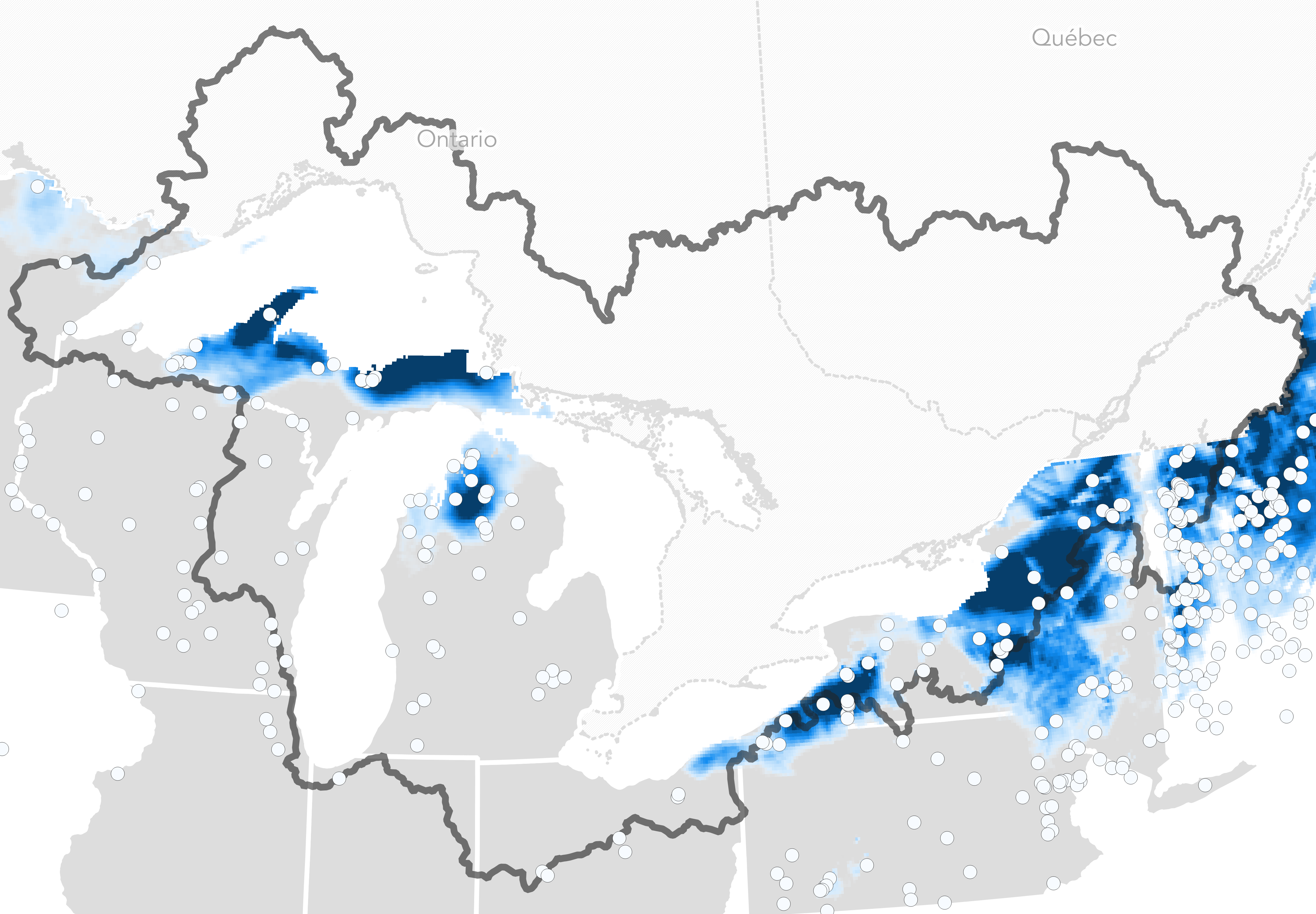
Yet another environmental oddity of the Great Lakes region is the existence of snowbelts or large areas impacted by lake effect snow. Lake effect snow across the Great Lakes occurs as a result of cold air rushing over relatively warm lake waters without ice yet. Once the lakes freeze over, which is becoming less common, the lake effect snow ends since the moisture can’t be drawn into the air.
The west side of Michigan experiences the snowbelt effect the most all along the Eastern coast of Lake Michigan, but areas of Ontario and New York also see heavy lake effect snow. Most recently, the City of Buffalo, NY — sandwiched by Lake Erie and Lake Ontario — experienced a deadly lake effect blizzard that left 39 people dead and many stranded for days.
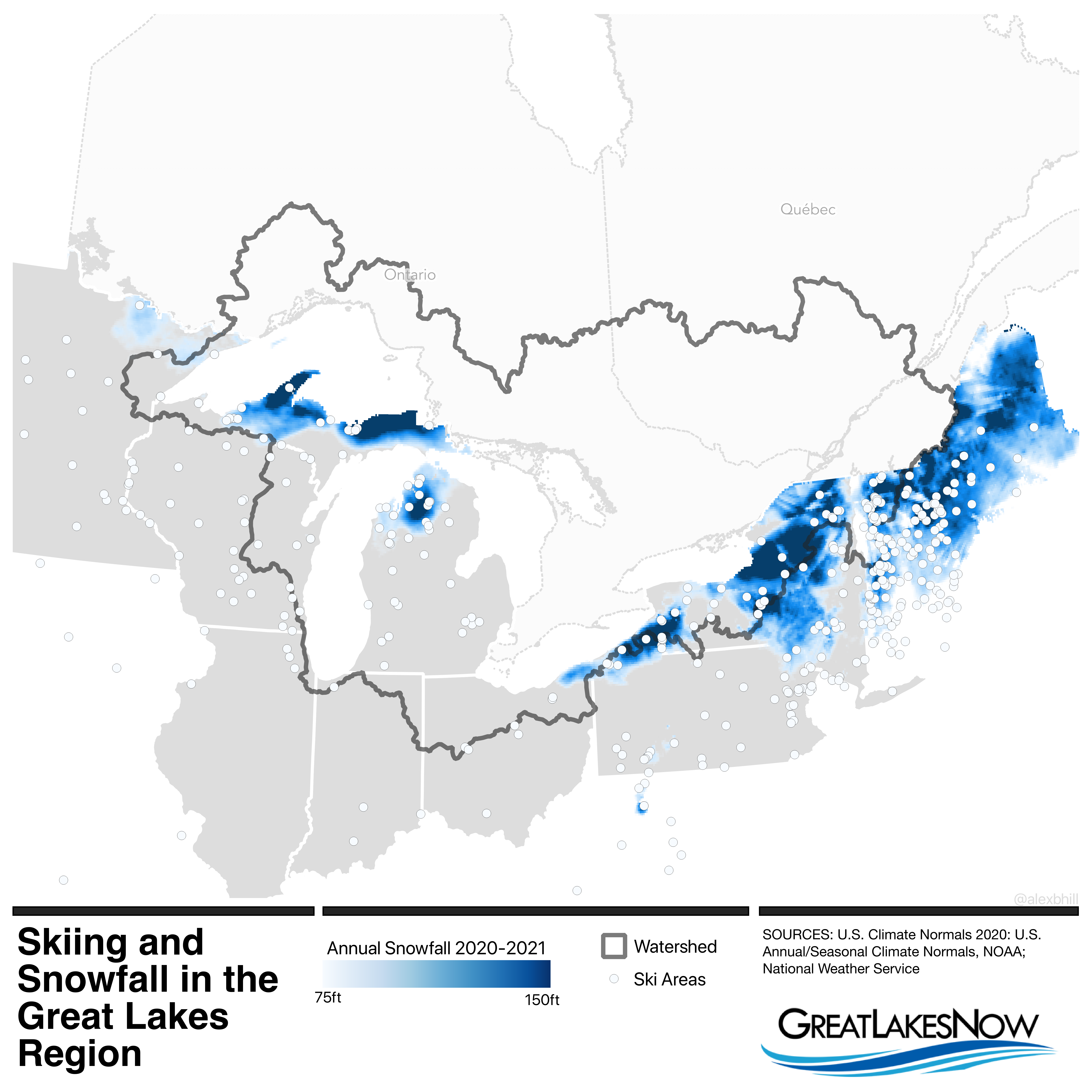
The data for this map comes from the National Oceanic and Atmospheric Association (NOAA) for the 2020-2021 season. The lake effect is easy to see on the edges of the Great Lakes giving the region yet another moniker — “snowbelt” — for its uniqueness. I also mapped ski areas on top of the heaviest snowfall areas. There is no correlation, but some of the areas known for better skiing do fall within these snowbelt areas. Some of the best skiing in the Great Lakes region can be had in Michigan’s Upper Peninsula and northern Lower Peninsula as well as New York’s Snow Ridge.
Climate change has already affected the snowbelt and ski season. There is very likely to be an increase in lake effect snow as the lakes freeze over more slowly or less frequently. Similarly, temperatures continue to increase and the snow that the snowbelt is known for may become mostly rain.
