
Significant areas of the Earth’s surface across continents are gradually sinking and that process brings environmental, social and economic consequences to urban centers in the United States. Great Lakes cities Detroit and Chicago are among those at risk.
That’s the conclusion of a recent study conducted by Columbia University researchers, published by the science journal Nature Cities.
Subsidence, the scientific term for the sinking of the Earth’s surface, has generally been thought to be a coastal problem connected with rising sea levels. But the research that used satellite data indicates it’s broader than the coasts. All U.S. cities with a population over 600,000 were sampled and 25 of the 28 cities were found to be sinking. Houston is sinking at the fastest rate.
The causes of subsidence are varied but include groundwater extraction, population growth and even the weight of buildings in big cities. A 2023 New York Times series on groundwater said, “ its overuse is draining and damaging aquifers nationwide.”
Great Lakes Now contacted the sustainability offices of the cities of Detroit and Chicago for comment on the study but did not get a response. The National Oceanic and Atmospheric Administration (NOAA) did not respond to a request to comment.
Michigan Department of Environment Great Lakes and Energy spokesperson Jeff Johnston did not offer comments on behalf of the agency, referring Great Lakes Now to Western Michigan University’s Department of Geological and Environmental Sciences.
To gain a greater understanding of land subsidence particularly related to Detroit and Chicago, Great Lakes Now conducted an email interview with Leonard Ohenhen, a postdoctoral researcher at Columbia’s Lamont-Doherty Earth Observatory. Ohenhen was the lead researcher on the project with support from other universities.
Great Lakes Now: What prompted the subsidence, sinking cities study in the U.S.?
Leonard Ohenen: We undertook this study to address a critical but often under-recognized and underappreciated hazard of land subsidence in urban areas. Our goal was to provide a nationwide, data-driven assessment using satellite observations to identify where land subsidence is occurring, how extensive it is, and which populations and infrastructure are most at risk.
GLN: Given that subsidence is generally more prominent in coastal cities, were you surprised that Chicago and Detroit are at risk?
LO: Yes and no. Coastal cities tend to draw attention because they face compounded risk from both land subsidence and sea-level rise. But subsidence is not exclusive to the coasts, it can also affect inland cities built on soft soils or with histories of groundwater withdrawal. In both Chicago and Detroit, the rate of subsidence in both cities was surprising.
GLN: How severe is the risk if unaddressed? Slight, moderate, potentially high over time? Over what time frame?
LO: If subsidence continues unaddressed, the long-term risk ranges from moderate to high, depending on local geology, water management, infrastructure vulnerability or other existing hazards. The cumulative impacts of subsidence range from localized, where hotspots exist such as cracking or uneven pavement to widespread and persistent over decades.
Long-term and incrementally, land sinking can lower ground elevations, increase exposure to flooding and damage critical infrastructure. The cumulative nature of subsidence makes it especially dangerous because it progresses quietly until critical thresholds are crossed at which point repairs, retrofits and mitigating its compounding effects become far more costly.
GLN: Is the biggest risk to infrastructure (buildings, roads, etc.) or risk of flooding? Some areas of Detroit already have flooding issues.
LO: Both risks are significant and interconnected, but it is city dependent. Land subsidence can compromise roads, pipelines, bridges and building foundations, leading to cracking, and long-term structural strain. At the same time, when land sinks, it effectively lowers the ground level relative to rivers, lakes, and stormwater systems, which increases flood risk even during routine rain events.
The risk to infrastructure manifests with uneven settlement across a city or infrastructure, but in Chicago and Detroit, both cities are sinking almost evenly throughout the entire city. This means the greatest risk is unrelated to infrastructure hazard but flooding. In places like Detroit, where some areas already experience flooding, subsidence can exacerbate the problem by reducing the effectiveness of drainage and making certain neighborhoods more vulnerable.
GLN: What are your recommendations based on the research for city mayors, state agencies, and the federal government?
LO: First, cities need to monitor land motion regularly. What isn’t measured can’t be managed. Second, city planners and engineers should integrate subsidence data into infrastructure design, zoning decisions, flood risk modeling and long-term city policy. For state and federal agencies, investment in groundwater management and urban resilience programs is critical. A proactive approach today can prevent billions of dollars in future damages. Ultimately, coordinated planning across agencies is essential to avoid transferring risk from one jurisdiction/district to another.
GLN: What is your advice to the general public concerning subsidence? The people who will experience the impact if it’s unaddressed.
LO: While subsidence may seem like a technical issue, it directly affects everyday life, especially through infrastructure vulnerability and flood risk.
Most people are not attuned to the risk of land subsidence because it unfolds gradually and often without obvious warning. But the signs can show up in everyday ways, for example, cracks in walls or pavement that reappear even after repairs, or areas that hold water longer than they used to after rainfall. These may seem minor, but they can signal underlying ground movement. My advice will be to stay informed and observant. If you notice these signs in your neighborhood, it’s worth asking whether land motion is being monitored.
GLN: Other thoughts?
LO: Subsidence is a slow-moving hazard, but its consequences are real and growing. What makes it especially dangerous is that it’s often invisible until it becomes expensive. The good news is that we have the tools to measure it and the knowledge to manage it. With timely action, we can ensure that cities are safe and resilient.
Catch more news at Great Lakes Now:
Weathering the floods: Detroit neighborhood faces uncertain future due to climate change
Chicago reveals climate havens don’t exist — they must be created
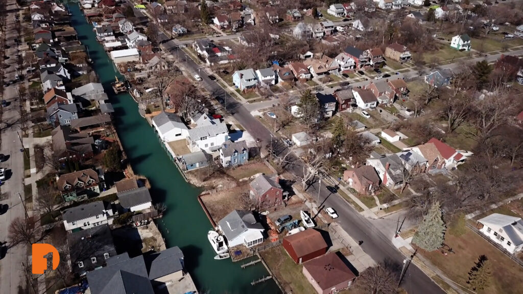
Featured image: An aerial view of the canal that runs behind the Jefferson Chalmers neighborhood on Detroit’s lower east side. (Photo Credit: One Detroit)
