Editor’s Note: This column was updated on April 7, 2021, to correct some of the numbers.
Great Lakes Moment is a monthly column written by Great Lakes Now Contributor John Hartig. Publishing the author’s views and assertions does not represent endorsement by Great Lakes Now or Detroit Public Television.
The Eastern Seaboard has the Appalachian Trail, the Western Seaboard has the Pacific Rim Trail, and the Rocky Mountains has the Continental Divide Trail. If the Community Foundation for Southeast Michigan has its way, southeast Michigan will soon have a regional trail of national significance called the Great Lakes Way.
In 2001, the Community Foundation for Southeast Michigan launched the GreenWays Initiative. Thus far, $33 million in foundation and private contributions have leveraged another $125 million of matching investments to plan, design, finance and build more than 100 miles of connected greenways across southeast Michigan.
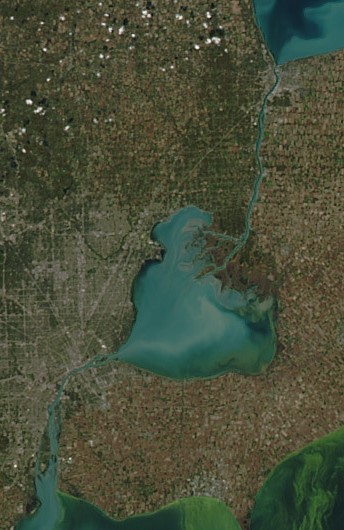
Building on this foundation, the Community Foundation together with regional partners developed a vision map for the Great Lakes Way – an interconnected set of 156 miles of blueways or water trails and 160 miles of greenways stretching from southern Lake Huron through western Lake Erie. The vision is that all residents and visitors of southeast Michigan are connected to and benefit from world-class freshwater, wildlife, recreation, and heritage right in our backyard through the Great Lakes Way.
An emphasis will be placed on ensuring that all residents and visitors – people of all ages, backgrounds, ethnicities and interests – feel welcomed and share in its benefits. This Great Lakes Way will improve close-to-home outdoor recreation, enhance regional competitive advantage, help attract and retain employees for businesses, and celebrate, protect and capitalize on our region’s defining natural resources.

Great Lakes Way vision map (Image from Community Foundation for Southeast Michigan)
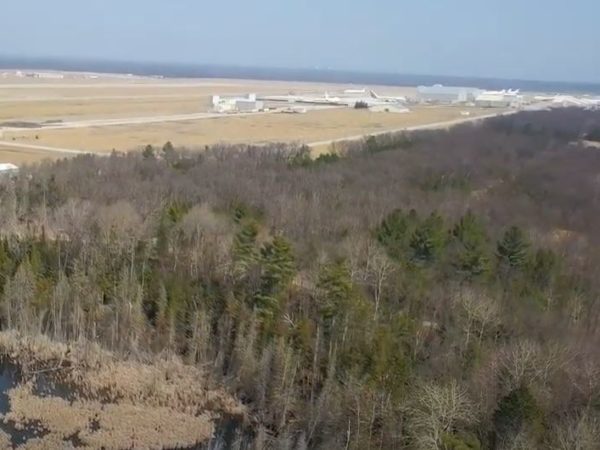
The Great Lakes Way is rich with world-class fisheries, flyways, parks, bustling urban centers and small village towns, preserved old growth woodlands and restored wetlands, history and industrial heritage, and working waterways. Traversing through the Great Lakes Way offers experiences that can only be found here.
Along the Great Lakes Way you can find two Wetlands of International Importance; one of the largest freshwater deltas in the world – St. Clair Flats; four Important Bird Areas designated by the National Audubon Society; the only international heritage river system in the world – the Detroit River; the only international wildlife refuge in North America – the Detroit River International Wildlife Refuge; one of the three best places to watch hawk migrations in the United States; one of the top 10 metropolitan areas for waterfowl hunting in the United States identified by Ducks Unlimited; an internationally renowned sport fishery that attracts tournaments offering $500,000 – $1.5 million in prize money; and a Regional Shorebird Reserve designated under the Western Hemispheric Shorebird Reserve Network.
Along the Great Lakes Way, you can also learn about the history of our region, including the Underground Railroad, the culture of Native Americans, shipbuilding, Historic Fort Wayne, River Raisin National Battlefield Park, unique MotorCities National Heritage Area sites, and more.
“The Great Lakes Way will be truly unique,” said Tom Woiwode, director of the Community Foundation for Southeast Michigan’s GreenWays Initiative. “It will connect people in southeast Michigan to the amazing cultural, historical, and natural resources right in their backyard and connect communities to each other.”
All the blueways or water trails are complete and available for use. Preliminary mapping of greenways found that:
- 61 miles (38%) are completed and assessed as safe and comfortable for the majority of users;
- 42 miles (26%) have partial connection meaning that they provide either completed code compliant pedestrian or bicycle connections, but not both or the bicycle connection does not meet National Association for City Transportation Officials’ standards for safety;
- 40 miles (25%) have a planned route, but currently no pedestrian or bicyclist accommodations;
- and 17 miles (11%) need to be completed for both pedestrians and bicyclists.
By any measure, the value of the Great Lakes Way will be impressive. Traversing on and along these world-class waters will reconnect people with their cultural, industrial and natural resource heritage. Benefits include: promoting outdoor recreation – in Michigan, $26.6 billion spent annually on outdoor recreation; catalyzing economic development – in its first 10 years, the Detroit RiverWalk spurred approximately $1 billion of investment in the public and private sectors; increasing adjacent property values – an Austin, Texas, study found that homes close to a greenway had a 20% higher mean sales price; connecting young people with nature – 80% of all people in the U.S. live in urbans areas and many are still disconnected from nature; celebrating historical and cultural assets – the economic impact of MotorCities National Heritage Area alone in $410 million annually; supporting healthful living; and improving quality of life.
“The Great Lakes Way will showcase the power of connectivity among people, communities, and the renowned natural and cultural features of southeast Michigan,” said Andrea LaFontaine, executive director of Michigan Trails & Greenways Alliance. “The Great Lakes way is a demonstration of the positive impact that can come from collaboration.”
Next steps in the process of establishing the Great Lakes Way include:
- engage communities and put the Great Lakes Way into the consciousness of residents and visitors through live and virtual events;
- build support and seek additional partners;
- raise necessary funds to fill trail gaps; and
- seek a national trail designation to raise its profile and help ensure long-term sustainability.
Stay tuned for opportunities to provide input and get involved. More information can be found at GreatLakesWay.org.
John Hartig is the chairperson of the Great Lakes Way Advisory Committee.
John Hartig is a board member at the Detroit Riverfront Conservancy. He serves as the Great Lakes Science-Policy Advisor for the International Association for Great Lakes Research and has written numerous books and publications on the environment and the Great Lakes. Hartig also helped create the Detroit River International Wildlife Refuge, where he worked as the refuge manager until his retirement.
Read more Great Lakes Moments on Great Lakes Now:
Great Lakes Moment: Beavers come knocking at the Detroit River’s former Black Lagoon
Great Lakes Moment: It’s a UFO. No, the aurora borealis. No, it’s Leamington greenhouses!
Great Lakes Moment: A new vision for the former McLouth Steel site in Trenton
Roller Coaster: Michigan’s long history with environmental contamination
Featured image: Huron-Erie Corridor (Image Credit: NASA)


