
By Lester Graham, Michigan Radio
The Great Lakes News Collaborative includes Bridge Michigan; Circle of Blue; Great Lakes Now at Detroit Public Television; and Michigan Radio, Michigan’s NPR News Leader; who work together to bring audiences news and information about the impact of climate change, pollution, and aging infrastructure on the Great Lakes and drinking water. This independent journalism is supported by the Charles Stewart Mott Foundation. Find all the work HERE.
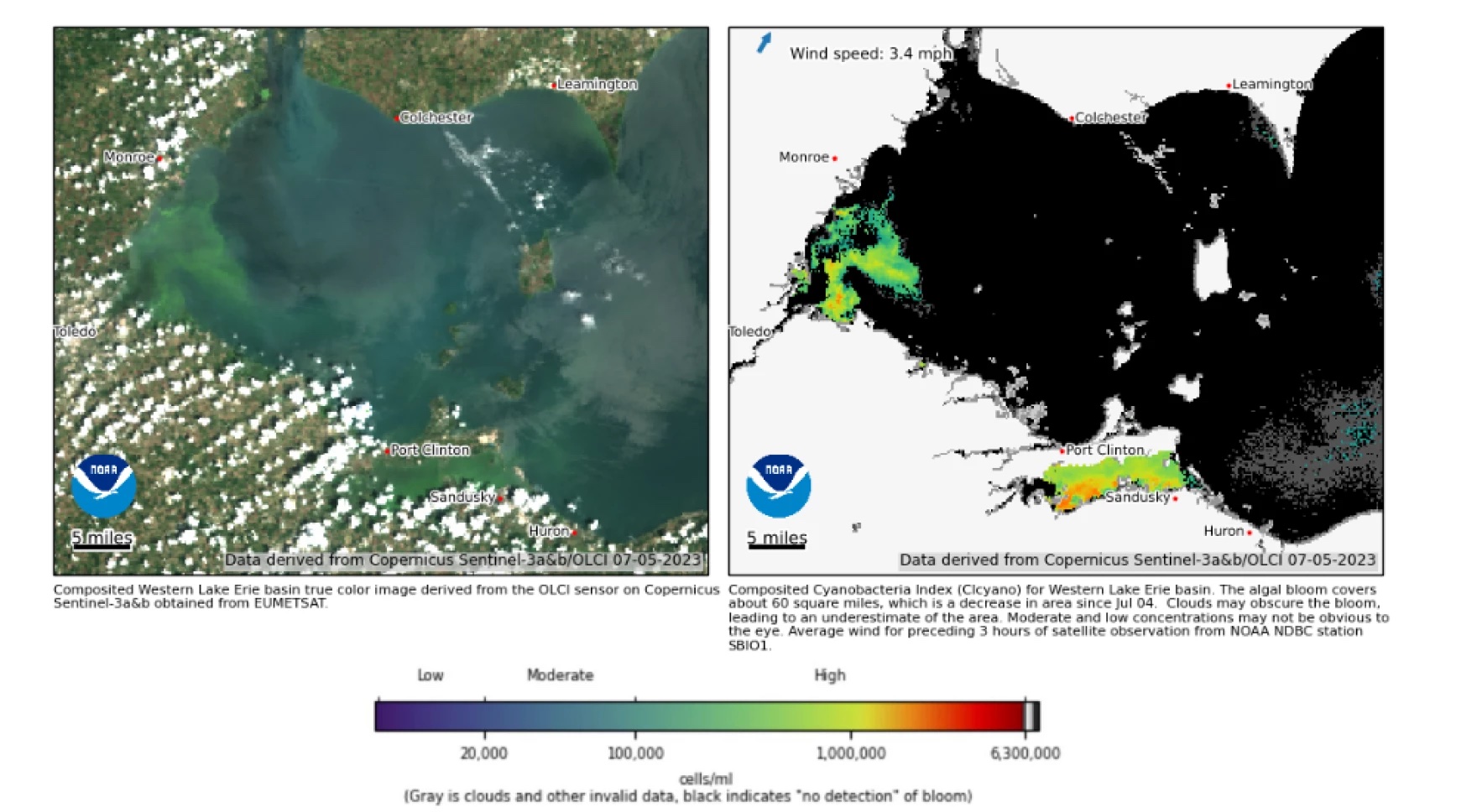
Harmful algal blooms are forming in some parts of Lake Erie earlier than typical. Satellite images released by the National Oceanic and Atmospheric Administration NOAA on Wednesday (July 5) show cyanobacterial blooms forming along coastal areas.
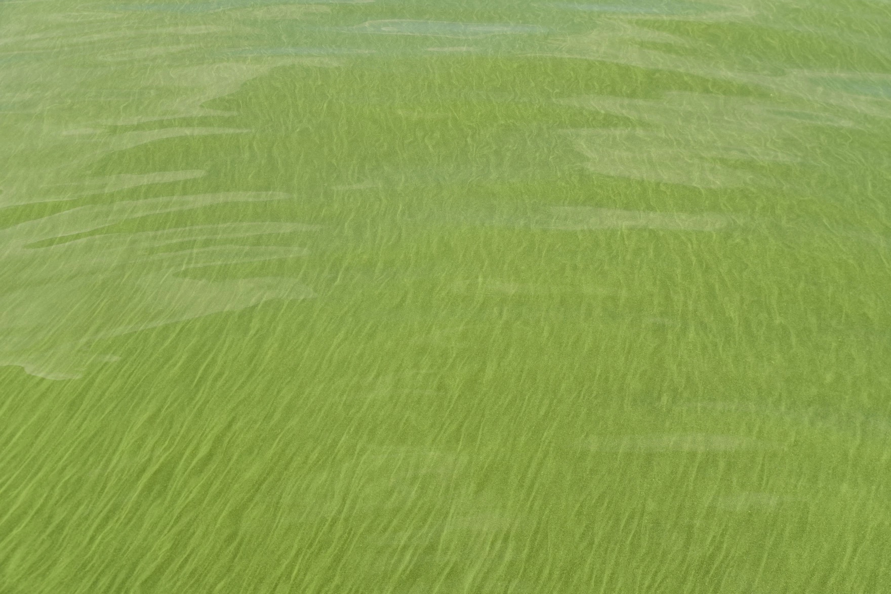
Researchers from the University of Michigan based Cooperative Institute for Great Lakes Research (CIGLR) were taking samples of Lake Erie water on the same day. One of the sampling sites was covered with what look to be cyanobaterial blooms –sometimes called blue-green algae.
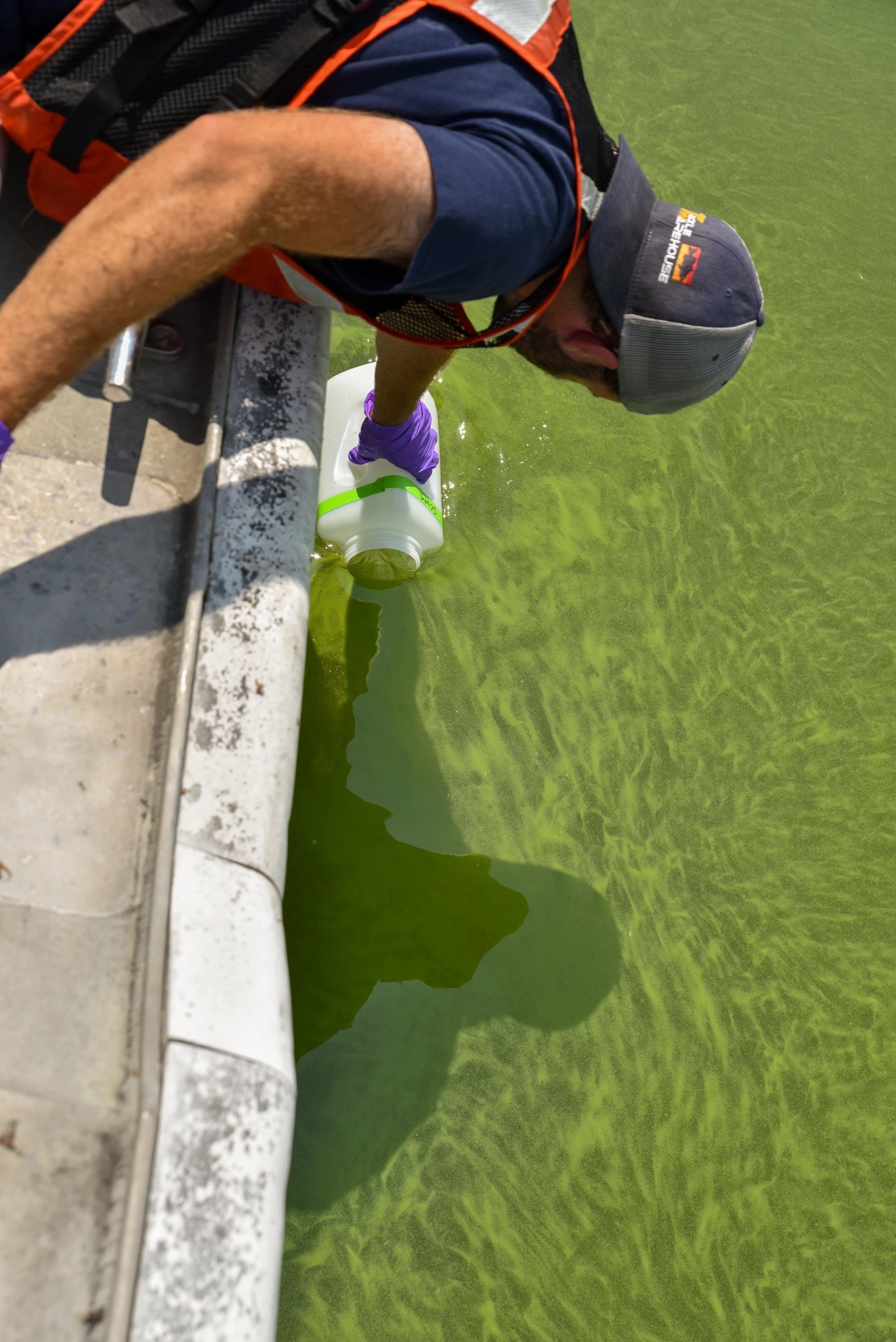
Andrew Camilleri with CIGLR was surprised to find the blooms this early in the summer. Typically, they don’t start forming until August and some years as late as September or early October.
The harmful algal blooms were located on the eastern side of Maumee Bay near Toledo.
“It’s really shallow there. And so, if you do get a rain, those nearshore areas are certainly going to warm up first and then also be very responsive to that near-shore runoff,” said Ed Verhamme with Limno Tech. That company places environmental data buoys in the lake to monitor conditions.
He said recent rains might have stirred up phosphorous which accumulated near the bay which primarily originated from agricultural sources in the Maumee River watershed.
“This year we had hot, dry conditions. But, that doesn’t mean that a lot of phosphorus wasn’t delivered before that happened. So, I think it’s just been this spring warm up and how stagnant the water has been with the warm weather we’ve had,” Verhamme said.
A NOAA forecast issued June 29 projected a “smaller-than-average” bloom. Rick Stumpf with NOAA said the severity of the bloom was expected to be around “3.” Last year’s harmful algal bloom severity was 6.8. The highest severity index was 10.5 in 2015.
“The forecast doesn’t consider warm months or cold months or wet last week and dry next week,” Verhamme said.

He described the forecast as looking at the seasonal load of phosphorus in making its forecast for the peak expanse of the harmful algal bloom. Based on a very dry May and cooler weather in the spring, the conditions did not indicate a severe bloom.
Heavy rains in the spring can wash phosphorus loads downstream and those heavy rains didn’t develop this year.
Watching from the research vessel, the crew spotted a boat towing an inner tube with people on it through the green soup of cyanobacterial blooms on Wednesday.
During the forecast last week, Stumpf warned, “Keep yourself, your kids, and your dog out of the scum-like blooms or anywhere the water looks green.”
As reported last week, the blooms can release a toxin that damages the liver which poses a risk to people or animals that come into contact with it.
Catch more news at Great Lakes Now:
Lake Erie harmful algal bloom expected to be smaller than average
How to stay informed about air quality in Michigan
Featured image: On July 5, harmful algal blooms were spotted, forming on the east side of the Maumee Bay in the western basin of Lake Erie from a NOAA research vessel. (Photo Credit: Lester Graham/Michigan Radio)
