
Toronto – A North American Leader in Waterfront Revitalization
Editor’s Note: Find Great Lakes Moments on Great Lakes Now the first Monday of each month.
Critics argue that environmental cleanup is nice, but there are often more pressing economic priorities. Well, a recent case study of the cleanup of Toronto Harbour has shown that investing in environmental cleanup and restoration yields considerable economic and social benefits.
Indeed, if cities want to achieve competitive advantage, environmental cleanup and protection are essential, critical factors for future success.
Toronto is Canada’s largest city, a popular tourist destination and the capital of Ontario.
It is a multicultural metropolis and considered the financial and commercial center of Canada. Indeed, the Toronto Stock Exchange is one of the largest stock exchanges in North America in value of trading.
Some people, when they think of Toronto, might think of the 1,815-foot CN Tower or the world’s first sporting arena with a fully retractable roof, now called Rogers Centre and home of the Toronto Blue Jays.
#TowerTuesday #mycntower #cntower #tourcn #Toronto #sunset #coucherdesoleil pic.twitter.com/I1WCBP9oHw
— CN Tower/La Tour CN (@TourCNTower) January 8, 2019
Others might think of Toronto’s theater district that has the largest concentration of stage theaters in Canada or its well-known cuisine that reflects its diversity.
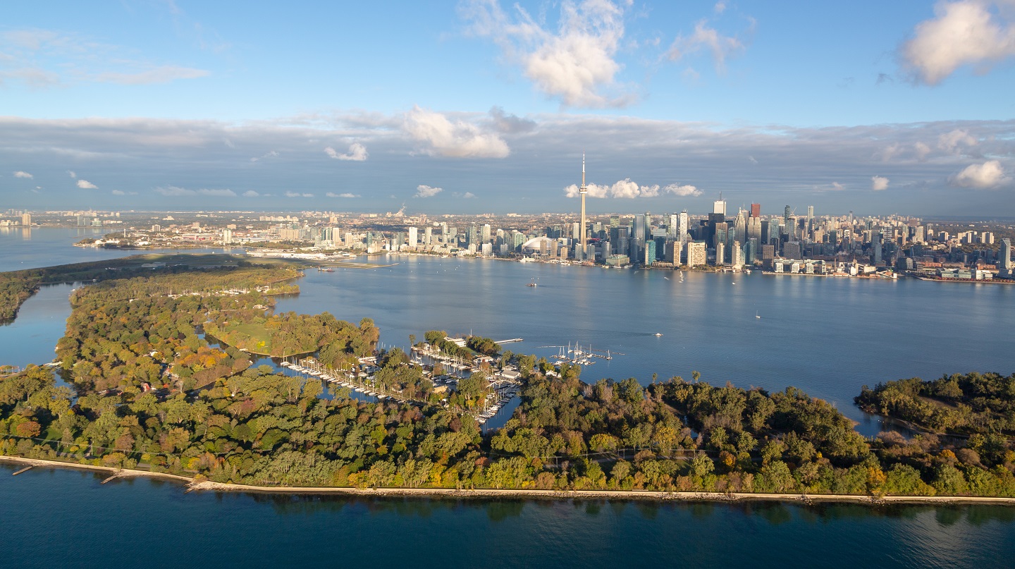
But Toronto is also known as a North American leader in creating a waterfront sense of place for both people and wildlife.
Toronto is situated on the northern shore of Lake Ontario and is one of the fastest growing urban areas in North America.
As with most large North American cities, it has suffered from the impacts of industrialization and urbanization, including poor water quality, contaminated sediments and fish, loss of wildlife habitat and populations, and beaches that were often closed due to high levels of bacteria.
Cleanup and Restoration of Toronto Harbour
In 1985, the International Joint Commission identified the metropolitan Toronto region as one of 42 Great Lakes Areas of Concern (AOCs) or pollution hot spots that required remedial action plans to clean up the harbor and restore all impaired beneficial uses using an ecosystem approach.
The Toronto regional AOC extends from Etobicoke Creek in the west to the Rouge River in the east and includes six major watersheds that drain into Lake Ontario, including Etobicoke Creek, Mimico Creek, the Humber River, the Don River, Highland Creek, and the Rouge River.
These watersheds drain an area of over 770 square miles and include 26 miles of waterfront, 11 municipal jurisdictions, and over 4 million people.
An action plan for the region was developed during the late 1980s and early 1990s under the guidance of the federal and provincial governments and with strong local support from Toronto and Region Conservation Authority.
Early efforts focused on controlling contaminants at their source through legislation, regulations, and voluntary, beyond compliance initiatives.
In addition, the City of Toronto, following adoption of a Wet Weather Flow Master Plan in 2003, spent $485 million to control stormwater pollution and reduce basement flooding risks. Toronto’s 10-Year Capital Plan for 2016-2025 identifies almost $2.8 billion for additional stormwater projects.
The Don River and Central Waterfront Project is particularly noteworthy. This project will capture and treat stormwater discharges and address discharges from combined storm and sanitary sewer outfalls to the Lower Don River, Taylor-Massey Creek, and Toronto’s Inner Harbour.
The project consists of three integrated tunnels (nearly 14 miles in total) connected to 12 underground vertical storage shafts, 27 connections to outfalls, seven off-line storage tanks, an integrated pumping station at the Ashbridges Bay Wastewater Treatment Plant, and a new wet weather flow high-rate treatment facility to be built south of Ashbridges Bay.
This $2 billion project is being implemented in stages over 25 years and upon completion will virtually eliminate the release of CSO discharges into the Don River, Taylor Massey Creek, and Toronto’s Inner Harbour, as well as reduce polluted stormwater discharges.
Construction of the first phase, the Coxwell Bypass, started in 2018 and will take seven years.
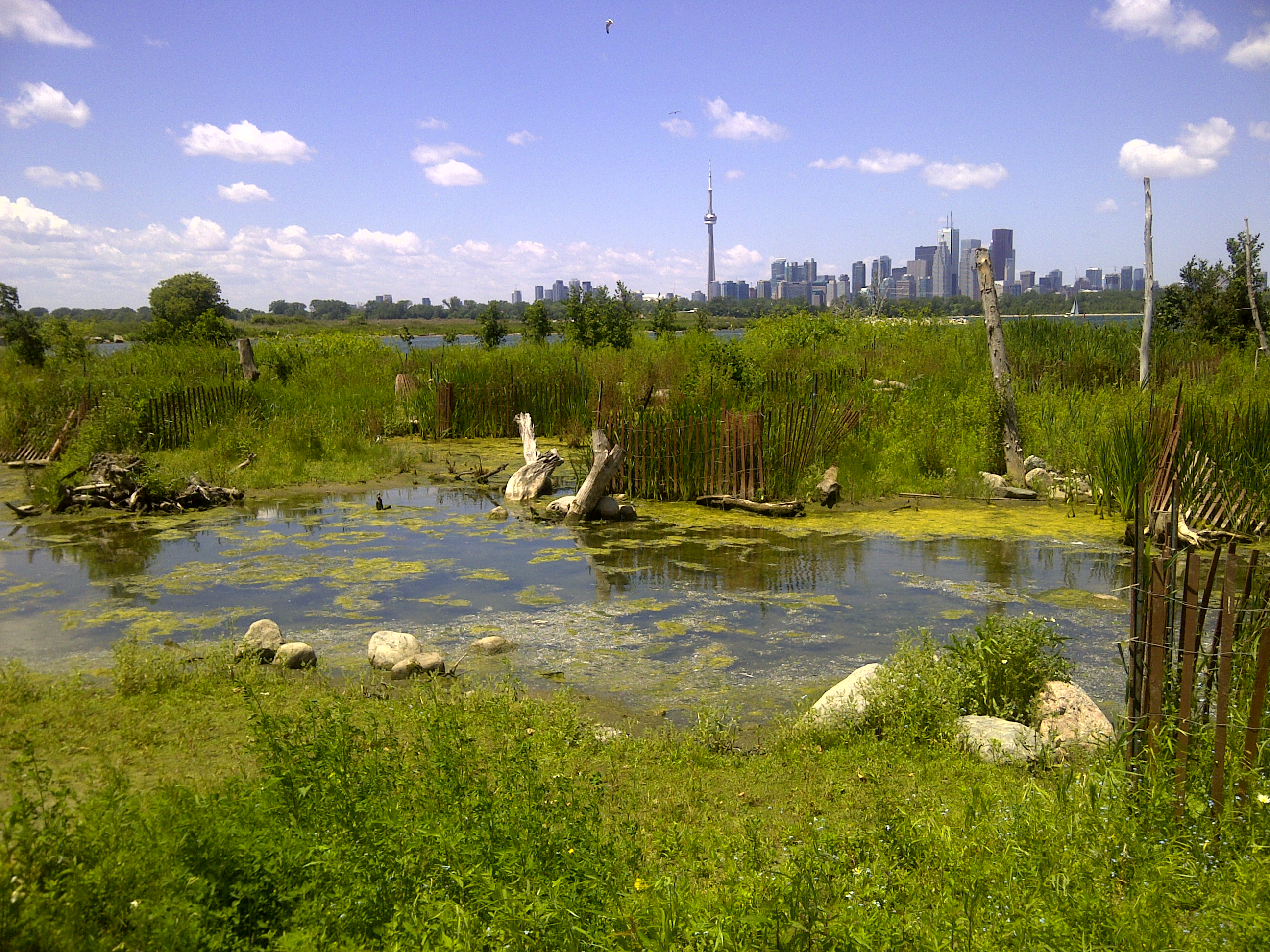
Habitat rehabilitation and enhancement has been another priority of the Toronto regional plan, with over $80 million invested since 1987.
In the last 10 years alone, over 2,000 acres of habitat and 36 miles of shoreline were created or restored in the AOC.
To further demonstrate conservation leadership, the federal government and Toronto created Canada’s first national urban park in 2011 – Rouge National Urban Park.
The Rouge Park is rich in natural, cultural and agricultural features including 1,700 species of plants and animals, and some of the rarest and best remaining wetlands, forests, and agricultural lands in the Greater Toronto Area.
It contains working farms, Carolinian forests, one of the region’s largest wetlands, unspoiled beaches, kilometers of hiking trails, and the city’s only campground.
Once fully established, Rouge National Urban Park will be 39 square miles in size – some 29 times the size of Central Park in New York. Federal investment in Rouge Park is projected to be $100 million.
In 2017, $1.25 billion was announced for the Port Lands Flood Protection and Don River Mouth Naturalization Project by the federal, provincial and municipal governments to revitalize Toronto’s eastern waterfront adding to the flood protection landform that was completed in 2012.
In the early 20th century, Toronto’s Ashbridges Bay Marsh was filled to create the Port Lands and the mouth of the Don River was straightened to form the Keating Channel.
The loss of this 1,058-acre coastal marsh negatively impacted flooding, aquatic habitat, and fish and wildlife diversity and abundance, which is one of the causes of Toronto being listed as an AOC.
This Project will construct a new naturalized river mouth through the Port Lands creating a new urban island neighborhood called Villiers Island.
The river valley will add 40 acres of new parkland, promenades and riverfront open space and create 35 acres of new aquatic habitat and wetlands to improve biodiversity, water quality and naturally moderate the effects of flooding and erosion.
Economic Benefits of Waterfront Revitalization
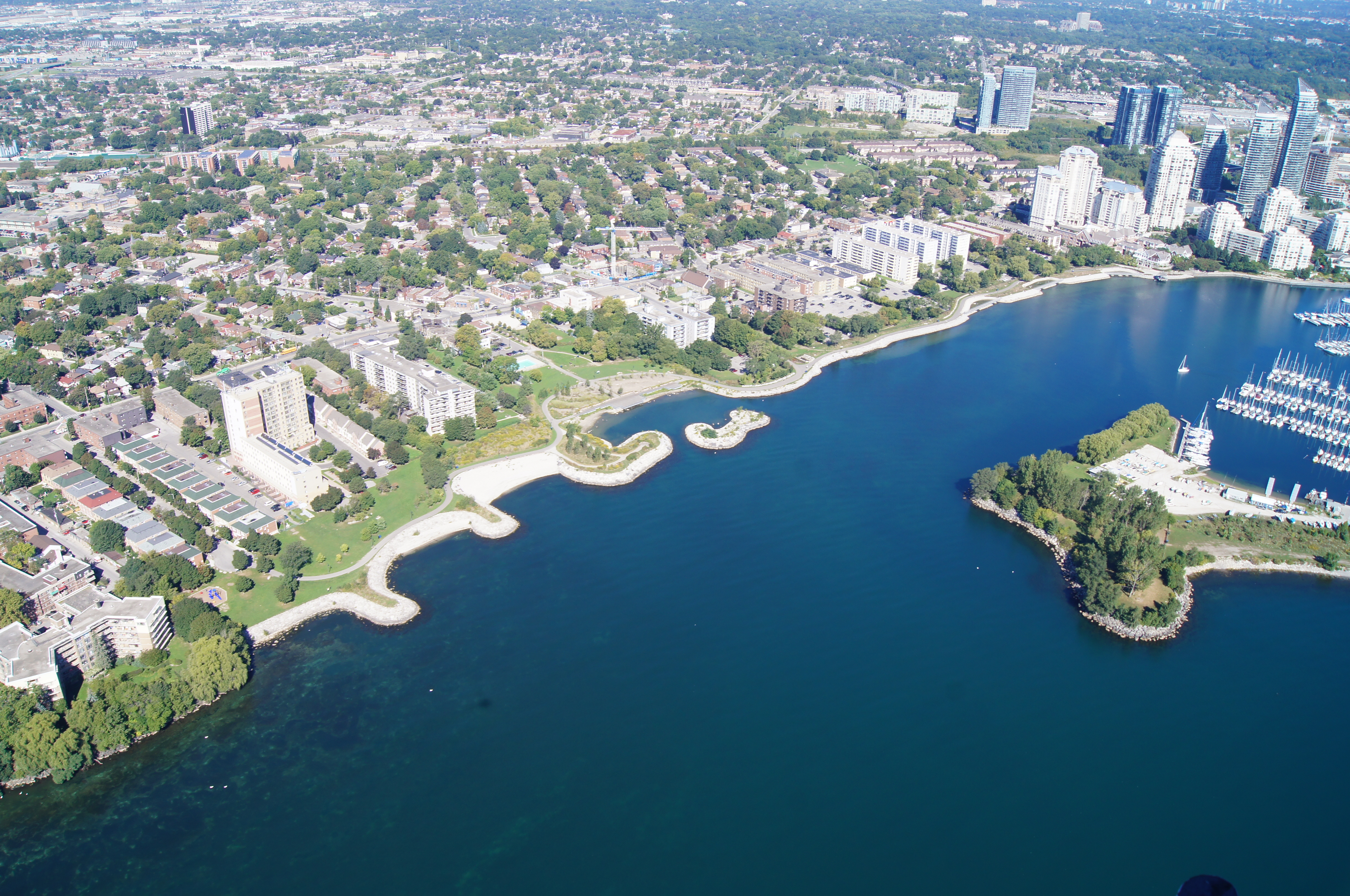
Over time, with the loss of many industries, Toronto’s waterfront became underused and unappreciated. In 2001, the Toronto Waterfront Revitalization Corporation (now called Waterfront Toronto) was established by the Government of Canada, the Province of Ontario, and the City of Toronto to rethink, reimagine, and redefine its waterfront as a priceless public asset that is accessible to everyone.
Working with public and private partners, Waterfront Toronto creates complete neighborhoods anchored by parks and public spaces, and diverse, sustainable, mixed-use communities that offer a high quality of life for residents, employees, and visitors alike.
This waterfront transformation is being undertaken for the use and enjoyment of the people of Toronto and across Canada to foster economic growth and to redefine how the city, province, and country are perceived by the world.
Waterfront Toronto has worked synergistically with the IJC’s metropolitan Toronto regional action plan to restore and sustain a vibrant ecosystem that provides environmental, social, and economic benefits to local communities and visitors.
For example, the agency developed a habitat strategy to support waterfront revitalization that resulted in restoring 74 acres of wetland and aquatic habitats and about 3.5 miles of shoreline habitat in prominent locations like Tommy Thompson Park, Toronto Island, Port Union, Mimico Waterfront Park, and others.
As part of an effort to measure economic effectiveness, Waterfront Toronto commissioned extensive studies of the economic benefits stimulated by Waterfront Toronto’s investment in Toronto’s waterfront.
Between 2001 and early 2017 some $1.6 billion was invested in waterfront redevelopment to make it a more compelling and people-oriented place.
Much like the effort to recreate front porches on houses in cities to encourage a sense of community, Waterfront Toronto is designing and building waterfront gathering places that are unique, create lasting memories, and foster a sense of authentic human attachment.
When adjusted for inflation, Waterfront Toronto’s $1.6 billion investment equals approximately $1.9 billion in 2016 dollars. Economists have estimated that this $1.9 billion investment will:
- Generate approximately 14,100 full-time years of employment, with nearly 90 percent in the City of Toronto;
- Stimulate $4.1 billion in total economic output to the Canadian economy (the majority of this economic growth will accrue in the City of Toronto); and
- Generate total government revenues of approximately $848 million.
Although Toronto Waterfront’s expenditures are significant, they are relatively small compared to the recurring benefits.
These include permanent jobs, property taxes, income taxes and tourism spending that will be experienced with the continued development of new office, residential, retail/service commercial, cultural, and entertainment uses along the city’s waterfront, which would not occur without the initial investments by Waterfront Toronto.
While the above impacts relate to Waterfront Toronto’s direct spending on planning and infrastructure, economists have also quantified benefits accruing to private- and public-sector real estate projects both on lands controlled by Waterfront Toronto and other privately owned land on the waterfront.
For example, the combined development on East Bayfront and West Don lands, and the adjoining neighborhoods, will generate nearly 207,900 years of employment, add $13.8 billion to the Canadian economy, and provide $7.5 billion in tax revenues to the three levels of government.
Clearly, Toronto has become a North American leader in harbor cleanup, revitalizing its waterfront and reaping economic benefits, and creating waterfront destination of choice that is accessible and welcoming to all. It might even be worth a trip to Toronto to see!
For more information visit: iaglr.org
