
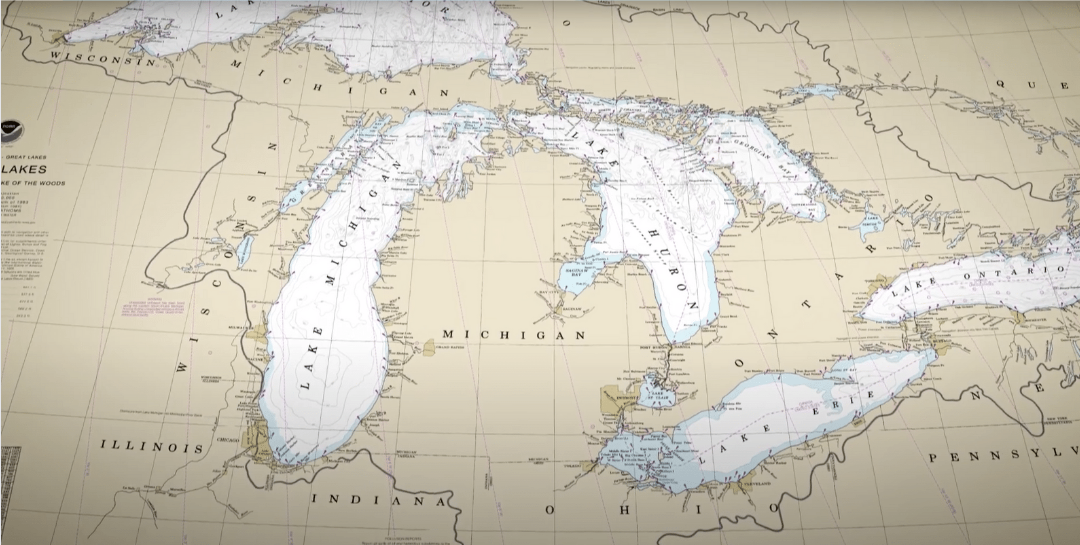
This lesson will explore the phenomenon of sound waves underwater used to map landforms and how modern technology is helping update the maps of the terrain beneath the Great Lakes. Students will learn about the history of mapping the lakebed and the SONAR technology used by NOAA to upgrade our maps.
Lesson Objectives:
- Know the history of our existing Great Lakes bathymetry
- Understand how modern technology is being used to map the bottom of the Great Lakes
- Be able to estimate the speed of sound in air
View the entire lesson plan including teacher background information, worksheets and more below or download for free here.
Activity 1
This activity is a video discussion of a Great Lakes Now episode segment discussing the use of SONAR to map the bottoms of the Great Lakes. During the video students need to jot down four things they took away from it.
Watch a Great Lakes Now Segment
Activity 2
The methods of mapping the floor of the Great Lakes have advanced by leaps and bounds over time. From lead sinker plumb line measurements to SONAR, the modern technology shaping Great Lakes bathymetry is nothing short of incredible. In this activity, students will use a Think Pair Square Protocol for discussing what they will read about this very topic.
Read About The Benefits of Bathymetry
Activity 3
In this activity, students will conduct an experiment to estimate the speed of sound in air. Depending on the space available, this could be done as a whole-class activity or completed in small groups.
Measure the Speed of Sound in Air
Activity 4
In this activity, students will complete a graphing exercise to learn how correction factors work in mathematical modeling. They will use this activity in order to understand how the NOAA technology used to map the Great Lakes terrain can correct its measurements to adjust for temperature variance in the water and accurately determine the lake depths using SONAR.
Mathematically Modeling Correction Factors
Activity 5
In this activity, students will model the original bathymetry techniques used to map the floors of the Great Lakes.
Mapping Terrain Using Plumb Lines
Check out Great Lakes Now’s segment on the bottom of the Great Lakes and other segments featured in Episode 2209: Finders, Keepers on this month’s landing page.
If you use this lesson or any of its activities with your learners, we’d love to hear about it! Contact us with any feedback or questions at: GreatLakesNow@DPTV.org
