
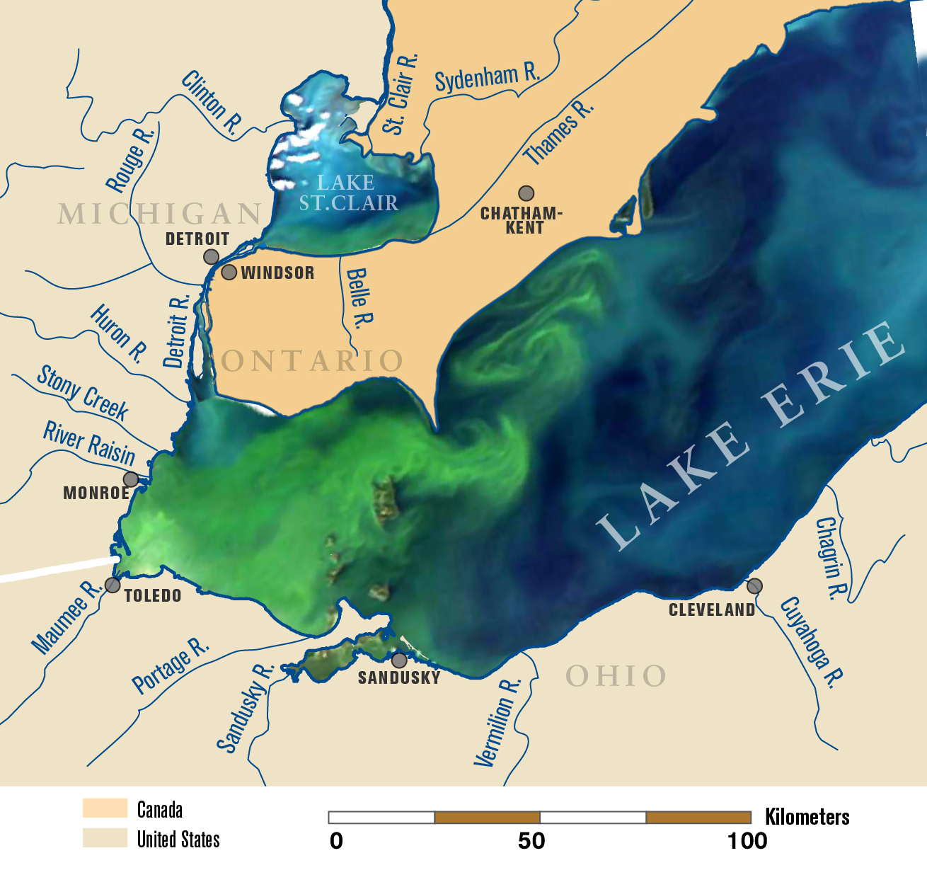
A satellite image of Lake Erie on Sept. 3, 2011, overlaid on a map of the lake and its tributaries. This image shows the bloom about six weeks after its initiation in the lake’s western basin. On this date, it covers the entire western basin and is beginning to expand into the central basin. Map by Michigan Sea Grant.
0 Comments
0 Likes