

By Ronia Cabansag and Adam Yahya Rayes, Michigan Public
The Great Lakes News Collaborative includes Bridge Michigan; Circle of Blue; Great Lakes Now at Detroit PBS; Michigan Public, Michigan’s NPR News Leader; and The Narwhal who work together to bring audiences news and information about the impact of climate change, pollution, and aging infrastructure on the Great Lakes and drinking water. This independent journalism is supported by the Charles Stewart Mott Foundation. Find all the work HERE.
It feels natural to say that there are five Great Lakes. It’s the kind of fact that feels as old and real as the lakes themselves.
But what if it isn’t true?
There may actually be four Great Lakes: “Lake” Huron and “Lake” Michigan could actually be considered “lobes” of one big lake — big enough to unseat Lake Superior as the world’s largest freshwater lake by surface area.
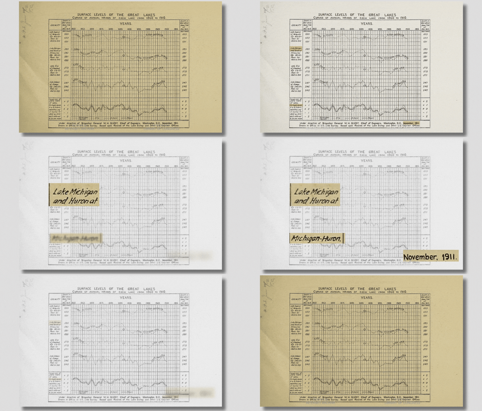
“They share a lake level. When the wind’s not blowing, they tend to be at the same level,” said Eric Anderson, director of hydrologic science and engineering at the Colorado School of Mines. “So if one goes up, the other one goes up. If one goes down, the other one does as well.”
The idea that Michigan’s mitten is hugged by one big U-shaped lake is not some new concept that you’ll only find buried in niche scientific studies.
It’s not very well known, but you don’t have to scroll far on Wikipedia, Michigan.gov or other very-public facing sources to find references to Lake Michigan-Huron.
The oldest scientific record of it we found was from 1911.
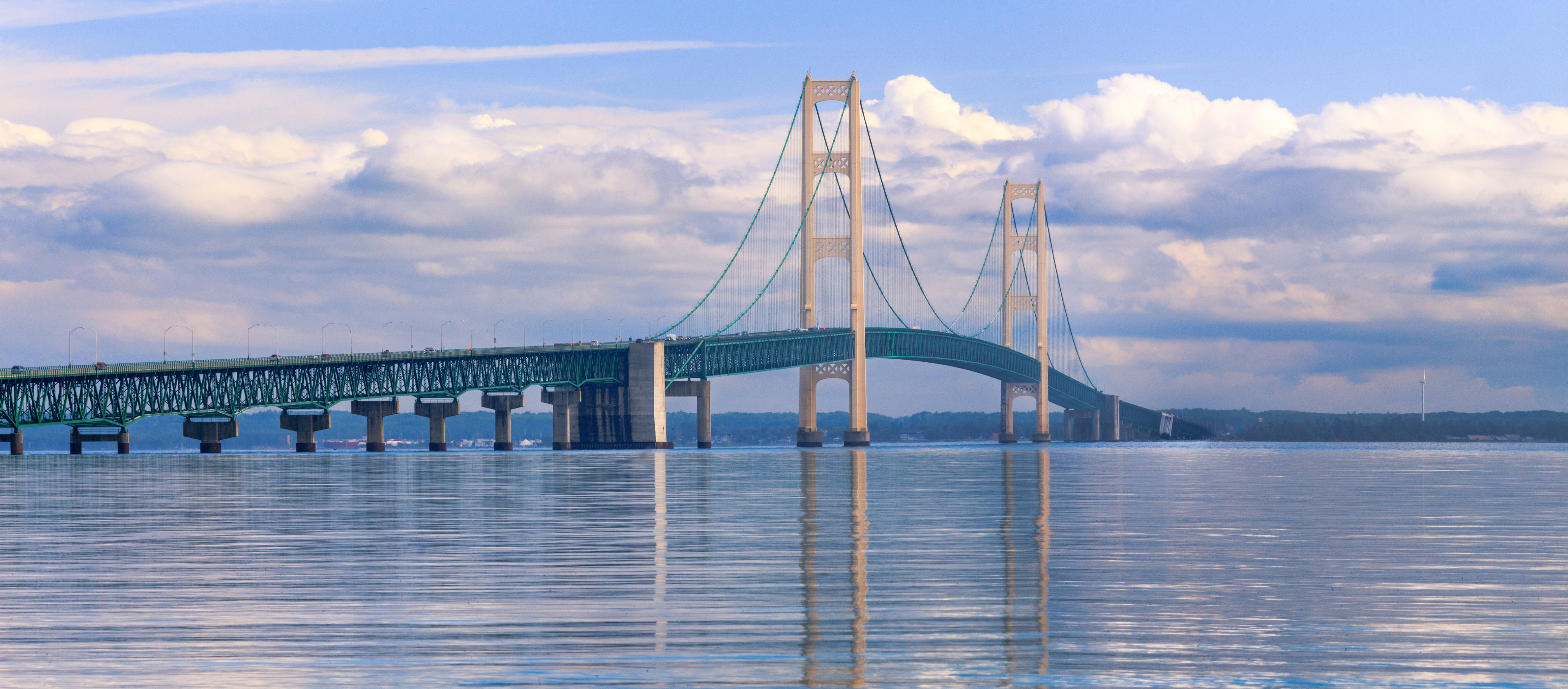
It’s not just the lake level that leads hydrologists to describe Huron and Michigan as one lake. The two bodies of water have another special connection: the straits of Mackinac.
At about five miles wide, the straits are a large body of water that flows in both directions between the Huron and Michigan lobes. This creates unique conditions for what Anderson called a “bi-lake seiche.” Seiches are standing waves that go back and forth across a body of water.
“Think about them as maybe like two water beds connected by some weird piece of material,” he said. “If you were to jump on the one water bed, right, you would create a giant wave that moves into the other one.”
That also means that any contaminants that spill into one body could easily end up in the other, Anderson said, especially if the spill happens near the straits.
But, Anderson said Michigan and Huron also have their own separate seiches. Plus, they each have their own circulation, water quality, and weather patterns. When he’s creating models to give people warnings about dangerous conditions, Anderson said it’s usually limited to one side or the other.
“In almost every other way, these lakes behave like two separate lakes,” he said. “Also just culturally and personally, because these lakes are so big, it’s really hard to think you’re experiencing the same thing in Chicago that you are in Georgian Bay.”
“Odawa Lake” and other names
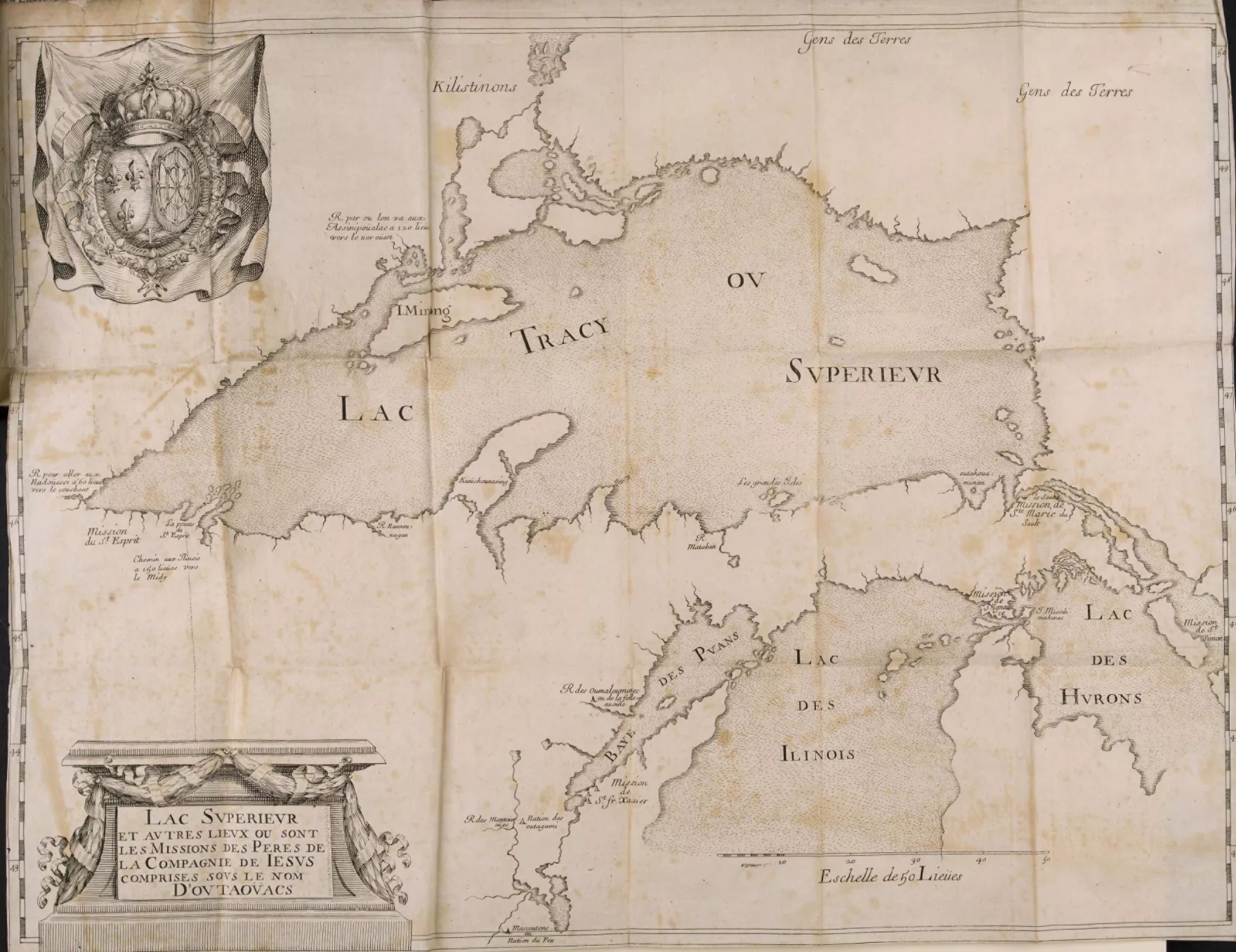
The earliest maps of the Great Lakes we know of are several hundred years old. Those maps, made by French explorers, refer to Michigan and Huron as separate lakes.
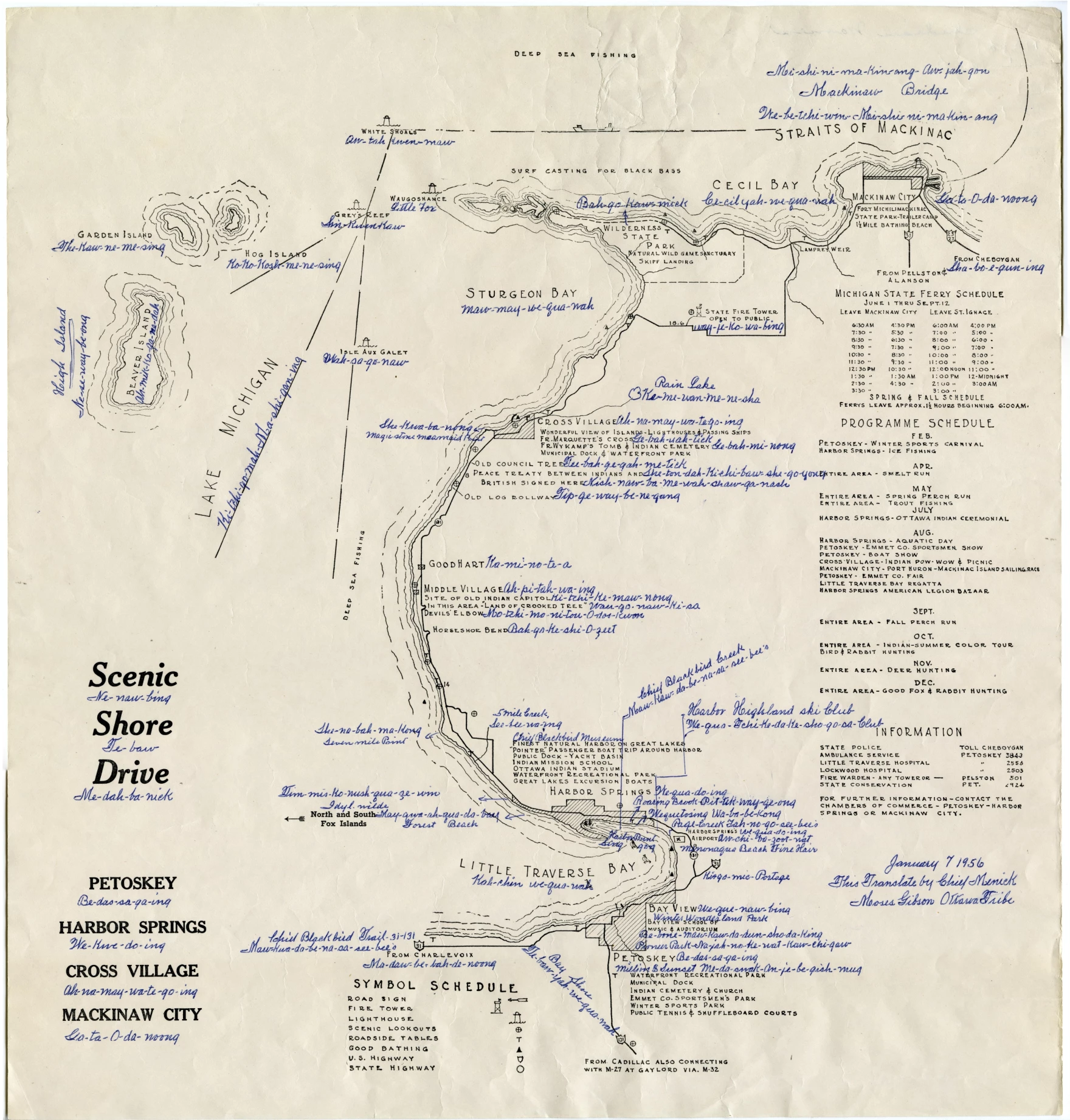
“I think it’s important to note that there are different names for these lakes that predate European contact,” said Eric Hemenway, humanities program manager for the University of Michigan’s School for Environment and Sustainability. “And there’s a different view of the lakes that is still with us.”
Hemenway is Anishinaabe — the collective name for indigenous peoples who lived in the Great Lakes region — and Odawa (also called “Ottawa”). His Odawa name is Gaanaybik (Ge-na-bik).
“So in my mind, as the singular Odawa guy from living on Lake Michigan, to me [Huron and Michigan] are one body of water,” he said. “And all of our villages historically were right on both sides.”
Hemenway used to do archival work for the Little Traverse Bay Bands of Odawa Indians. Historically, he said, the tribe called Huron and Michigan “Odawa Lake.”
“There’s no wall, there’s no giant barrier,” he said. “The important part is who lived where … I can’t say it’s exclusively ours. You know, we named the lake after us, but there were other tribes that lived on the lake.”
Hemenway said Anishinaabe peoples had many different ways of naming and categorizing the lakes. Some did consider Huron and Michigan to be separate lakes or bodies.
“We live in these boundaries all the time. And so, trying to pull back and not look at the boundaries is really difficult,” he said. “But if you start seeing it as one, I think you start seeing the effort and responsibility shifts. We all have a part in this.”
Guests:
- Eric Anderson, director of hydrologic science and engineering at the Colorado School of Mines.
- Eric Hemenway, humanities program manager for the University of Michigan’s School for Environment and Sustainability.