

An estimated 6 quadrillion gallons of water sit in the five Great Lakes and their connectors. That’s 6 million billion gallons worth of water.
But many Great Lakes communities get their drinking water from groundwater rather than the lakes, and the availability of this subterranean supply can be more volatile.
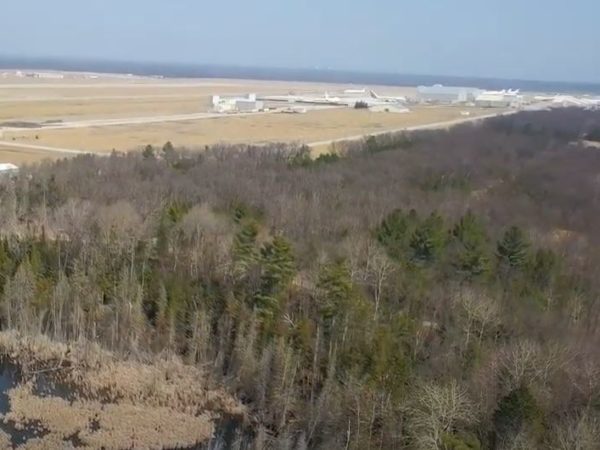
Watch Great Lakes Now’s segment on how a small Great Lakes coastal community that relies on groundwater realized it was running out of that water and how the community responded.
To help understand the dynamics of aquifers and underground water supplies, Great Lakes Now spoke with Audrey Sawyer, assistant professor at Ohio State University’s School of Earth Sciences. Sawyer’s research has focused on hydrogeology, surface water-groundwater interactions and coastal hydrology.
Here is an edited version of that conversation.
Great Lakes Now: What is an aquifer?
Audrey Sawyer: Basically it’s any rock that stores any reasonable amount of water that you can pump out.
GLN: What’s the difference between aquifers and groundwater?
AS: Groundwater is the water that’s stored in rocks. We use that term pretty loosely, so it can be the water stored in aquifers or it can be a rock that’s not really permeable enough to be an aquifer.
GLN: How much of the Great Lakes region depends on aquifers as opposed to the Great Lakes for water?
AS: I do know that around a third of Ohio residents depend on aquifers for a water source, and that number came from a publication from Ohio EPA.
GLN: Are Great Lakes aquifers in danger?
AS: It’s really just an undervalued resource. It’s water we have when we need it, even when there’s a drought, because aquifers are relatively protected from weather and outside factors when reservoirs and lakes are more impacted.
Partly because it’s out of sight and hard to measure, it’s sometimes surprising when it becomes clear that aquifers can be depleted due to misuse or mismanagement.
The other beauty of aquifers is a lot of times, they are somewhat protected from contamination relative to surface waters. A lot of that logic is surface waters are exposed while for aquifers the water has to pass through rock and gets filtered.
I think it’s easy to mismanage them, pump dry and deplete, because there are fewer stewards for them.
Audrey Sawyer
There are many times when the groundwater quality is much better than the surface water lying above it, so we want to protect aquifers and keep them as pristine as we can, because they’re a nice back-up resource when there are times we can’t drink the surface water.
And we don’t think about the Great Lakes region being dependent on groundwater because we have the lakes, but surface water and groundwater are connected, and we rely on both. Even in water-rich places, if you’re off the municipal water grid, you’re going to be relying on a domestic well.
GLN: What are the dangers aquifers face right now?
AS: It’s harder to monitor them compared to lake levels that are very visual. Groundwater, you have to drill a well just to be able to sample it. I think it’s easy to mismanage them, pump dry and deplete, because there are fewer stewards for them, and the data are harder to collect.
And then on top of that, they’re threatened by contamination. I said they’re less vulnerable to contaminants than surface water or a lake might be, but they still get contaminated and that’s a vulnerability.
GLN: Where does the water come from to fill an aquifer?
AS: It sits in aquifers for very long times, but a lot of the time the water comes from either lakes that still exist or lakes that used to exist, so it can be true that water that’s in the ground came from glaciers that melted thousands of years ago. Some of it comes from rain, so basically any rain that happened anywhere from days to tens of thousands of years ago. And of course snow melt as well.
GLN: Do high water levels in the Great Lakes affect the amount of water in an aquifer? Are they affected by weather in the same way?
AS: Groundwater flows just like surface water flows, but it’s a lot slower.
The groundwater flow rates tend to be slow in the order of inches to feet per day, but those flow rates and directions will change with seasons, as water recharges aquifers and infiltrates in. They’ll change if you have a flood. Those flow rates and directions will also change over droughts or in response to people pumping out of groundwater wells.
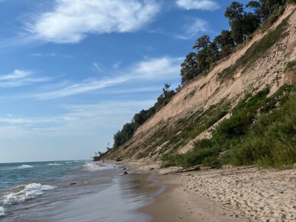
How saturated the ground is affects how easily the ground is eroded and that’s an issue in terms of shoreline stability, and there are times groundwater saturation at the base of bluffs affects how easily bluffs can be eroded.
The surface water and groundwater do interact as water levels fluctuate and as seasons pass. You can pump at groundwater sources around the shoreline and suck up lake water that comes in through the shore face. You can start to impact the quality of the water that’s being pumped out of the wells too.
Groundwater flows out into lakes and coastlines, so if you have a bunch of septic tanks that are leaky along coastlines, they’re a source of nutrients and contaminants to the surrounding coastal aquifer that sometimes discharges into the lake as well.
GLN: What can people do to protect aquifers?
AS: On the city planning level, it’s important to maintain natural land cover that allows aquifers to recharge, like small wetlands and places with trees and grass where you can still allow the aquifer to recharge and maintain connection to the surface when it rains.
On top of that, the same things people do to keep contaminants out of surface water will help keep contaminants out of groundwater. Road salts are an issue. All of the fertilizers we introduce to our lawns, to our farm fields. That gets into aquifers and messes with the groundwater quality.
And then also just the biggest thing individuals can do is advocate for supporting science as a voter. There’re always concerns about cuts to scientific research or, in some ways more importantly, entities like the U.S. Geological Survey that monitor water levels in our aquifers and monitor flood threats in our streams. The USGS does a huge service to make sure we understand our flood threats in flood-prone zones and also our groundwater resources.
Featured Image: Audrey Sawyer, assistant professor at Ohio State University’s School of Earth Sciences, Photo courtesy of Audrey Sawyer
2 Comments
-
Our group, the Williams co. Alliance is involved in protecting our aquifer. The is a businessman who proposed to sell our water to Toledo communities by piping it over 60 miles. People were passionate about the fact it isn’t his water to sell and there is no law against it. We petitioned the county to change the law by making our county a charter co. Needless to say, although we had enough signatures, we were stymied first by the Board of Elections and next by Common Pleas Court and then by Ohio Supreme court. No one ever looked at the language of the Charter but it was over where it was filed. We know that the powers that be do not believe in protecting the aquifer and do not want the people to have the opportunity to vote on issues that concern them. We are indeed an advocate for our Michindoh Aquifer especially since there is about 8 CAFO ‘s locating here in the last year. We feel helpless against.
-
It was interesting when the article talked about how an aquifer is a rock that has a reasonable amount of water stored in it. As far as I know, groundwater is generally accessed through a well that has been drilled into the ground. It seems like it would be important to make sure that a well is drilled in a location that has a lot of groundwater.
