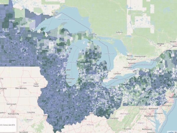
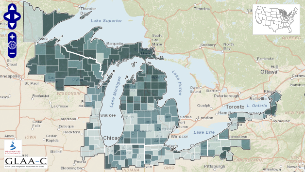
 The University of Michigan’s Graham Sustainability Institute in partnership with Headwaters Economics launched an interactive map on Tuesday with the goal of supporting climate change adaptation planning in the Great Lakes region.
The map provides social, economic and demographic statistics on 225 counties in the region with detailed data about municipal spending, land-use change and climate-change characteristics.
Read the University of Michigan news release in full here.
You can also take a look at the interactive map on the Graham Sustainability Institute website or the Headwaters Economics website.
0 Comments
0 Likes